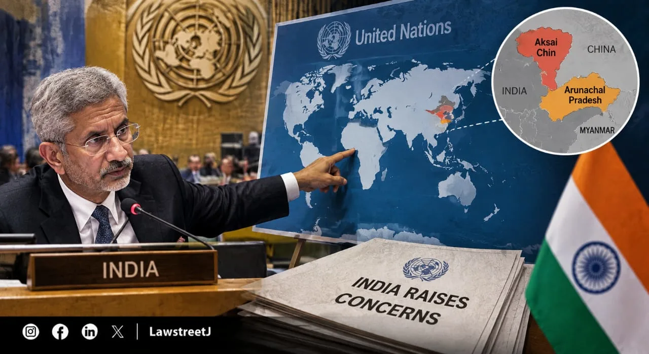
NEW DELHI - India has formally raised objections with the United Nations over a newly published UN world map that depicts Arunachal Pradesh and Aksai Chin as areas positioned between separate Indian and Chinese claim lines, rather than as clearly marked Indian territory. The controversy surfaced just days after New Delhi had voted in favour of a separate UN General Assembly resolution promoting more accurate, proportionate world maps, prompting India to clarify that its support for that resolution should not be read as endorsement of this particular map or its depiction of the India-China boundary.
What the New UN Map Actually Shows
The map in question, referred to as the UN Map of the World, was published by the United Nations on July 1, 2026. According to reporting on the map's contents, it uses a distinctive system of labelled lines to mark contested frontiers along the India-China border, rather than presenting a single, unambiguous boundary. In the eastern sector, Arunachal Pradesh's southern boundary with the Indian state of Assam is marked on the map as a "Chinese Line," while the state's boundary with neighbouring Nagaland is left out of the map entirely. At the same time, Arunachal Pradesh's northern boundary with China's Tibet region is marked as an "Indian Line." Taken together, this labelling effectively presents the entire state as existing in a kind of cartographic limbo between two competing claim lines, rather than as settled Indian territory, directly contradicting India's consistent position that Arunachal Pradesh is an integral and non-negotiable part of the country.
A similar pattern appears in the depiction of Aksai Chin, a high-altitude region currently administered by China but claimed by India as part of the Union Territory of Ladakh. On the UN map, Aksai Chin's eastern boundary is marked as an "Indian Line," while a separate "Chinese Line" is shown cutting through the region, appearing to separate Aksai Chin from the rest of Ladakh. This effectively isolates Aksai Chin as its own distinct area on the map, caught between the two claim lines much like Arunachal Pradesh. Notably, the map does handle a different disputed boundary elsewhere with more editorial caution, in Jammu and Kashmir, the Line of Control separating Indian and Pakistani-administered territory is shown as a dotted line, accompanied by an explanatory note stating that the dotted line approximately represents the LoC as agreed upon by both countries, and that the final status of Jammu and Kashmir remains formally unresolved. No comparable explanatory note accompanies the separate Indian and Chinese claim lines shown for Arunachal Pradesh and Aksai Chin, an inconsistency that has drawn particular attention in Indian commentary on the map, since it means one disputed boundary on the map comes with clarifying context while the other does not.
India's Response and the MEA's Clarification
Ministry of External Affairs spokesperson Randhir Jaiswal confirmed that India had formally taken up the anomalies in the map with the concerned authorities at the United Nations, describing the depictions of Arunachal Pradesh and Aksai Chin as inconsistent with India's established position. Jaiswal reiterated that India considers Arunachal Pradesh to be an integral part of the country, and that it regards the entire Union Territory of Jammu and Kashmir and Ladakh, including Aksai Chin, as an integral and inalienable part of Indian territory, language consistent with the government's long-standing public position on both regions.
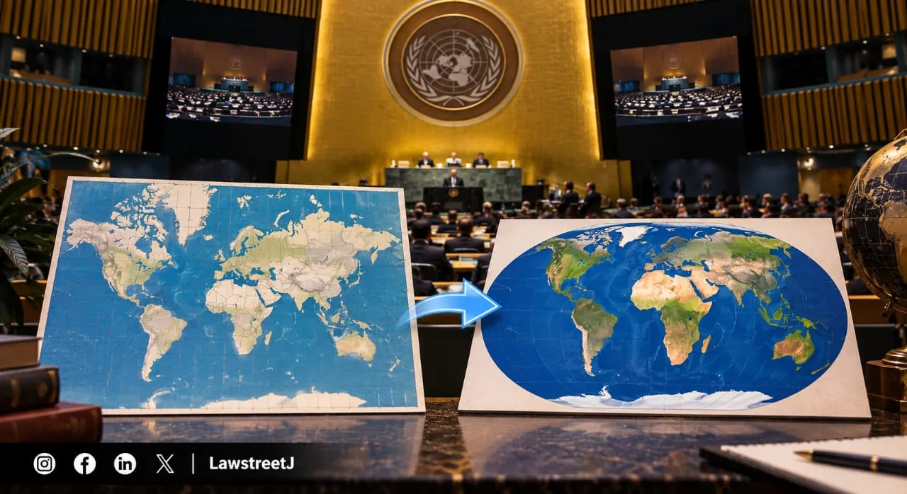
Crucially, Jaiswal also moved to separate this controversy from India's vote days earlier on the UN General Assembly's "Correct the Map" resolution, stressing that India's "yes" vote on that resolution was specifically about the mathematical accuracy of map projections, meaning how proportionately continents and countries are sized relative to one another and should not be interpreted as an endorsement of any specific map, including this one, or of any particular political depiction of disputed borders contained within it. According to MEA officials, the resolution itself does not adopt or authenticate any specific world map, it simply encourages broader use of equal-area projections such as the Equal Earth projection over the traditional Mercator projection. As of the latest reporting, the United Nations has not issued any public explanation for why Arunachal Pradesh and Aksai Chin were specifically depicted using this dual-claim-line format.
Why This Map Emerged Now: The "Correct the Map" Resolution
The timing of this controversy is directly connected to a broader UN General Assembly resolution, titled "Correct the Map: Rebalancing Global Cartographic Representation and Promoting Equitable Representation of the World's Regions, Particularly Africa," which was adopted on September 4, 2026. That resolution passed with strong support, 164 countries voting in favour, only the United States voting against, and six countries abstaining and encouraged wider global adoption of equal-area map projections, arguing that the traditionally dominant Mercator projection significantly distorts the relative size of countries and continents, particularly by making Africa appear far smaller than its true size relative to regions like Greenland. The campaign behind that resolution was led primarily by African nations, with Togo playing a leading role, and was framed around correcting centuries of cartographic distortion that campaigners argued had shaped global perceptions of Africa's size and significance.
India supported this broader resolution, aligning itself with the underlying principle that world maps should more accurately reflect the true proportional size of different regions. However, the newly surfaced controversy over the India-China border depiction illustrates a distinction the Indian government has been keen to draw, supporting the general cartographic principle behind proportional map projections is a separate matter entirely from endorsing how any specific UN-published map chooses to depict politically disputed and sensitive territorial boundaries, particularly ones directly involving India's own sovereignty claims.
A Familiar Pattern: India's Long History of Map Disputes With China
This is far from the first time India has objected to how its border with China is depicted on an official map. India and China have a long-running, unresolved territorial dispute along their shared border, and disagreements over how third parties depict this boundary on maps have surfaced repeatedly in the past. In 2023, China released an updated "standard map" that showed both Arunachal Pradesh and Aksai Chin as Chinese territory, prompting a strong diplomatic protest from New Delhi. At the time, External Affairs Minister S. Jaishankar publicly dismissed China's territorial claims as "absurd," while noting that such moves reflected what he described as an old pattern of behaviour from Beijing. India has similarly objected in the past to Chinese e-passports depicting Arunachal Pradesh and Aksai Chin as Chinese territory, at one point responding by issuing visas to Chinese nationals stamped with a map showing both regions as part of India. Set against this longer history, the current dispute over the UN's map depiction fits a broader, recurring pattern in which India has consistently and immediately pushed back whenever international cartographic material appears to present its sovereignty over these two regions as unsettled or contested, regardless of the source or the original intent behind the map's publication.